The White Pocket area in Arizona is an amazing place we basically stumbled upon. It is a bizarre landscape with swirling, multicolored formations of sandstone.
When we were visiting the Condor Viewing Site nearby, we asked one of the volunteers there where her favorite spot in the area is.
She said “White Pocket.” We asked her to explain what it was, and she said words can’t describe it, but that we should go and see it. She was 100% right!
When we visited the area, there were only about five other visitors there, so we basically had the place to ourselves. It was absolutely stunning, and definitely worth the effort to get there.
I took all of the photos on this page, but I am not a professional photographer by any means. For those of you who know what you are doing, there are some incredible photo opportunities.
What is White Pocket?
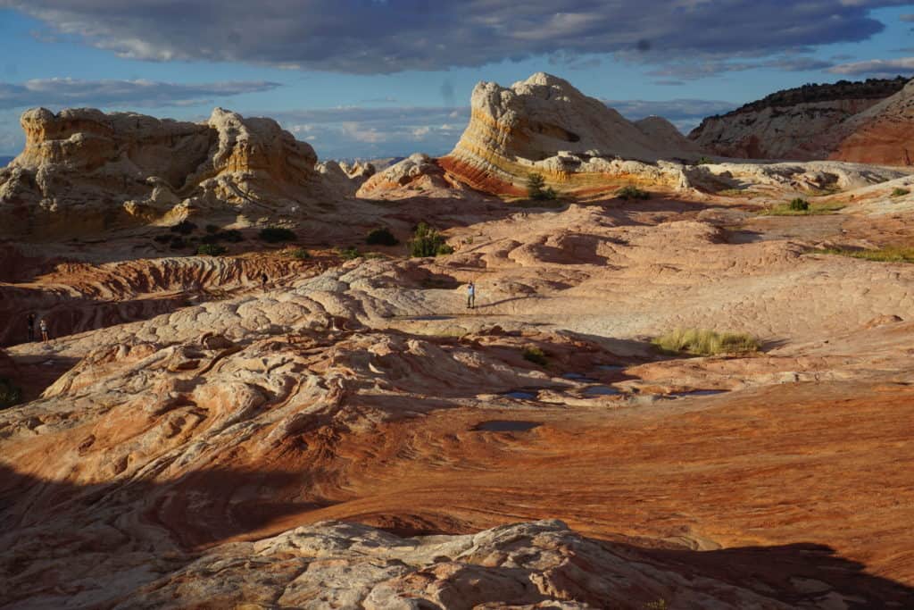
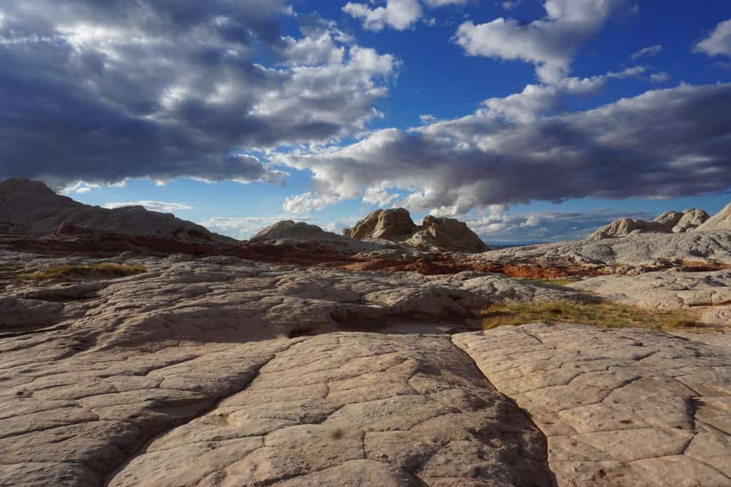
White Pocket is an extremely photogenic area in the Vermilion Cliffs National Monument near the Utah border in Arizona. It is not a huge area, as it covers about 100 acres.
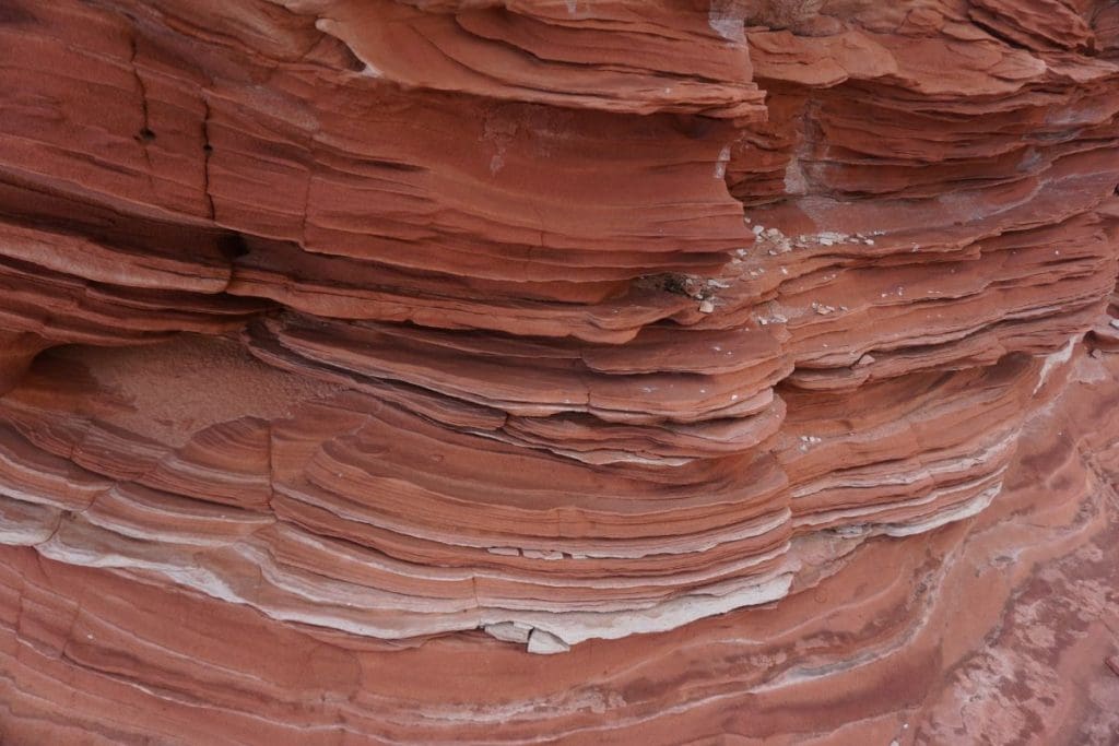
It consists of swirling, multicolored formations of Navajo sandstone, with layers stained in shades of white, gray, red, orange, and pink by iron oxide.

White Pocket is similar to The Wave in Arizona which is about 6 miles away as the crow flies (but takes a lot longer to drive to).
Some even regard this area’s striking landscapes as surpassing the beauty of The Wave.

The rock formations are made up of layers of Navajo sandstone, which have been bleached to a lighter color in some areas, hence the name “White Pocket.”


To me, it looks like the offspring of a creamsicle and marshmallow. Others have compared it to Candyland or swirled icing on a cake.
Geologists believe that this landscape was formed during the Jurassic Period through a combination of sand turning into rock and seismic activity shaping the layers and waves visible today.
Activities at White Pocket
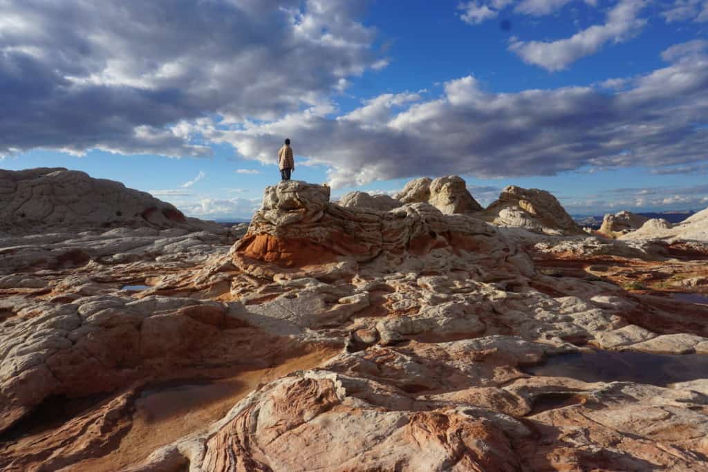
White Pocket is a dream destination for photographers.
Visitors can walk on the rock formations and take amazing photos.
If you like White Pocket, check out the Bisti/De-Na-Zin Wilderness Area in northwestern New Mexico. It is also an other-worldly place in the desert with hoodoos, natural arches, and other erosional features in shades of white, red, orange, and pink. Photographers take amazing photos there too.


When To Visit
The best time to visit White Pocket is during the spring or fall, as the desert can get very hot in the summer.
Visitors should be prepared for unpredictable weather and limited services in the area.
Permit and Fees
A permit is not required for entry, unlike the Wave.
There is also no entry fee.
Location
White Pocket is located northwest of Page Arizona, near the Utah border.
The Google Map below shows its exact location.
Getting There
The hardest part about White Pocket is getting there.
It is located deep in the Vermilion Cliffs National Monument area. The map below shows its location in the northwest corner of the map in Arizona.

You drive down the same gravel road as you would to see the Condor Viewing Area on BLM 1065.
From there, White Pocket is only accessible via a challenging 4×4 road. You will drive down a series of very sandy, and in some cases deep sand, roads that require a high-clearance vehicle with four-wheel drive.
The BLM has provided a map (below) to help guide you to the location of White Pocket. Be sure to either print this out, or have some off-line mapping tool that will get you there. Cell service is most likely not available.

There are numerous signs reminding drivers of this requirement, including the importance of knowing the differences between 4×4, all-wheel drive, and 2-wheel drive.
Only 4×4 drive vehicles can pass through the roads to get to White Pocket.

The roads along the way are very well-marked, so as long as you have a 4×4 high-clearance vehicle such as a Jeep or pickup truck, you should be able to get there with no problems.
Once You Get There

Once you make it to White Pocket, there is ample parking. Proceed westward from the parking area, following the trail for approximately 100 yards.
As the BLM points out, there isn’t a specific trail to follow, so you will just wander around the sandstone formations as you please.

Final Thoughts on White Pocket
White Pocket will blow you away. If you’re a photographer at heart, you will be in an amazing place for taking photos, particularly at sunrise and sunset.
Enjoy your time there, but be prepared! It’s not easy to get to, but it is worth it!


