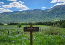
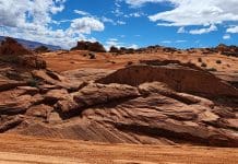
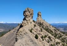
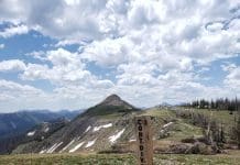
Kolob Arch, one of the largest freestanding arches in the world, is a stunning natural formation located in the less-visited Kolob Canyons section of Zion National Park in Utah. The hike to Kolob Arch traverses the park’s less-visited backcountry, so it is a nice respite from the sometimes very busy area of Zion Canyon, the main part of the park. We hiked the La Verkin Creek Trail from the Lee Pass trailhead to see the arch in April 2024.
Kolob Canyons Area of Zion National Park
Zion National Park has three entrances, which is not something we initially realized when doing this hike. The main (south) entrance is by Springdale. There is also an east entrance along Highway 9, and a third entrance for Kolob Canyons in the northwest section of the park.
For this hike, enter at the Kolob Canyons entrance. It is located about 40 miles southwest of the main Zion Park entrance by Springdale.
Kolob Canyons Description
Kolob Canyons is a 45,000-acre section of Zion National Park in the park’s northwest corner. Unlike the main Zion Canyon, which is more accessible and crowded, Kolob Canyons offers a remote and serene experience with narrower, deeper canyons and towering red cliffs.
At a higher elevation, it features cooler temperatures and different flora and fauna, providing a more isolated and intimate encounter with Zion’s natural beauty.
Meaning of “Kolob”
Mormon pioneers settled in the region in the mid-19th century. They named the area “Kolob” after a star or heavenly body mentioned in the Book of Abraham, part of the LDS scripture. The name reflects the settlers’ awe of the landscape’s beauty.
Access to Kolob Canyons
Unlike the main Zion Canyon area of the park, you are allowed to drive your car into the Kolob Canyons area.
There is a Kolob Canyons Visitor Center where you can pay your fee to enter the park and obtain additional information. It is staffed with park rangers.
The Kolob Canyons Road is 5 miles long and covers the length of this part of Zion.
This scenic drive provides stunning views of the deep red canyons and towering cliffs, as well as access to several trailheads and viewpoints.
Lee Pass Trailhead Hike Details
The hike to Kolob Arch follows the La Verkin Creek Trail from the Lee Pass Trailhead on Kolob Canyons Road.
There are sign along Kolob Canyons Road that point to the Lees Pass trailhead and parking is available at several small lots along the road.
It is 14-15 miles round trip, with an elevation gain of about 1,040 feet.
The trail is mostly flat, except for about the first mile. The beginning of the hike which is downhill (and uphill on the way back)!
It should take about 6-8 hours to complete, depending on your pace and how much time you spend at the Kolob Arch.
Zion Wilderness Area
The Kolob Canyons are designated as Wilderness Areas. This hike goes through the Wilderness Area.
A Wilderness Area is a protected region where the land remains in its natural state, free from significant human development. They are managed to conserve natural and cultural resources, wildlife habitats, and ecological integrity.
Only hikers and horse riders can access Wilderness Areas. Bikes and motorized transportation are not allowed.
Terrain along La Verkin Creek Trail
The La Verkin Creek Trail starts at the Lee Pass Trailhead and gradually descends into the Kolob Canyons. This first part of the trail is downhill.
It eventually lands in the valley of the narrow box canyon, which has red sandstone cliff walls that are over 2,000 feet tall. These provide amazing views the entire length of the trail.
The trail winds through juniper and pine forests, open meadows, and alongside La Verkin Creek.
You’ll pass through riparian zones with cottonwoods and box elders, and navigate more rugged sections as you approach the Kolob Arch spur trail.
Rivers along La Verkin Creek Trail
You will hike along two different rivers on this trail. These are the Timber Creek and La Verkin River.
We crossed several rivers crossings on the trail. I counted over 20. All were easy to do without getting our feet wet.
Kolob Arch
Kolob Arch is one of the largest natural arches in the world. It is approximately 287 feet in length and is considered to be one of the world’s longest freestanding arches.
It is the second longest natural arch in the United States. Only Landscape Arch in Arches National Park is longer, at about 300 feet in length.
To be honest, the arch itself is somewhat anticlimactic. We were not terribly impressed with the arch, but the hike to see it was pretty!
(For a more impressive arch along a pretty canyon trail in Moab, check out the Morning Glory Arch!)
Kolob Arch Spur Trail
At about the 6.5 mile mark, you will come to the Kolob Arch spur trail, which is only about 1/2 mile long. There is a sign that points to the spur trail.
The spur trail is a little more challenging than the main trail, as you will need to scramble over some rocks.
This part of the hike follows a freezing cold stream to the left of the trail. We thought it would be a good idea to cool off our feet in the stream, but it was freezing in April when we visited!
Seeing the Arch
Kolob Arch can be a little difficult to see if you don’t know where to look. It is located on the left-hand side of the Kolob Arch spur trail, across the river from the side that the trail is on.
Once you come to the sign below, look up high to your left. Some other hikers left some notes on this sign to show you where to look.
The arch is located high up in the cliffs, so you will need to look up to find it.
If you see this white streak on a cliff about the trail, look just to the left of it and you will see the arch.
Once you’ve seen the Kolob Arch, return back along the spur trail to the main trail and retrace your steps. From here it is about 6 miles to the Lee Pass trailhead.
Permits for La Verkin Creek Trail
You do not need a permit to hike the trail. However, if you want to camp, a permit is required. There are several established campsites along the trail.
To get a back country permit to camp in Kolob Canyons, you have to go to the Springdale entrance of the park, so plan your trip accordingly.
Warnings and Considerations
Rattlesnakes
Keep an eye out for rattlesnakes. They are prevalent in this area.
We didn’t see any, luckily. The only wildlife we saw were some mule deer, who weren’t terribly bothered by us.
Mosquitoes
The mosquitoes can be really bad, given the amount of water in the area. Bring bug spray.
Cacti
Watch where you step if you go off the trail. There are a lot of cacti in this area, including small cacti that can be difficult to see.
As well as several beautiful big cacti along the trail that are hard to miss.
Sun Protection and Water
Most of this hike is in the sun. Make sure you bring lots of water and sun protection.
We thought we were well prepared, but almost ran out of water at the end of the hike. Bring more than you think you will need.
When we hiked this trail, there was a sign at the beginning reminding hikers to bring enough water.
Mud
If it has rained recently or there is snow melt, the trail could get very muddy. This is sticky wet clay, which is not easy to walk through.
Even though the trail was mostly dry when we hiked, there were areas where we could see where the rain had recently run off. These were very muddy, giving us a taste for what the mud could be like.
Last Mile of La Verkin Creek Trail is Uphill
The last mile or so is completely uphill. Take that into consideration, as we were pretty tired after already hiking 14 miles.
Make sure you leave enough time to finish hiking the trail before dark.
There’s a picnic table at the Lee Pass trailhead where you can have a snack before or after hiking the trail.
No Dogs
Dogs are not allowed on the trail.
Getting There
Google Map of the Lee Pass Trailhead
Directions
To reach the Lee Pass Trailhead of La Verkin Creek Trail:
- Enter Zion National Park from the Kolob Canyons entrance, located off Interstate 15.
- Stop at the Kolob Canyons Visitor Center to present an Interagency Park Pass or pay the Zion National Park entrance fee.
- Take Kolob Canyons Road for about 4 miles to the trailhead parking area at Lee Pass. There are signs for Lee Pass.
The Kolob Canyons Road may be closed during winter months due to snow or ice.
Road workers had stopped traffic to bust large boulders that had rolled onto the road when we were there in the spring.
Follow this link to check on the current conditions.
Final Thoughts
We loved this part of Zion National Park. When we visited in April, the main Zion Canyon area was packed with people. It was a little too crowded for my taste. (We hiked up to Scout Lookout which was not as crowded as other trails in the main Zion area, as the hike is considered to be difficult.)
On the other hand, Kolob Canyons was quiet and peaceful and we almost had the whole place to ourselves. We only saw a few other hikers.

