Would you like to see a mountain valley full of purple wildflowers? We did a relatively easy hike near the Weminuche Wilderness and came to a valley full of Rocky Mountain Irises. It was gorgeous and unexpected. This trail is located about an hour north of Pagosa Springs, Colorado. This hike is along a section of the Weminuche Trail that is near Williams Creek Reservoir. It is a very rewarding hike given the field of wildflowers at the end.
Mountain Valley Full of Wildflowers
To give you a taste of what we experienced on this hike, see the short video clip below. I took this in the middle of June when the wildflowers were in full bloom. This video is from the Weminuche Valley near Pagosa Springs, Colorado.
Trail from Poison Park Trailhead
To get to the valley of wildflowers, we hiked the first 2 1/4 miles of the Weminuche Trail (FS Trail #592). We hiked from where the Weminuche trail starts at the Poison Park trailhead, and then hiked back, for a total of about 5 miles.
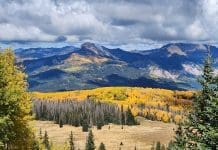
The trailhead elevation is a little over 9,200 feet. It goes downhill for the first 2 1/4 miles. You will have some pretty mountain scenery along the way.
The Weminuche Valley (where the flowers are) is at about 8,800 feet in elevation, so be prepared to hike uphill for about 600 feet for the return trip.
Other than the uphill climb on the way out, the trail is not difficult.
We encountered a grouse along the trail. It flew away once it saw us, but I was able to get a quick video of it.
You are likely to see lots of other wildlife in this area if you keep your eyes peeled.
As you get further along the trail, it starts to flatten out a bit and enters some wide open areas.
Wildflowers Along Trail
We saw lots of wildflowers along the Weminuche Trail. Some of these we know the names for, but not all.
These included white wildflowers.
We also saw pretty wildflowers along a stream.
We saw wild violets as well. These are the purple flowers below.
There was also a lot of woods rose growing along the trail. These produce pretty pink flowers.
There were also pretty yellow flowers. The best time to see the mountain wildflowers is usually around June or July, so plan your hike for then if you can.
Weminuche Valley
Once you descend the 2 1/4 miles from the Poison Park trailhead on the Weminuche Trail, you will come to the trail sign below. You will now be in the Weminuche Valley.
The property behind the fence is privately owned, so stay on this side of the fence.
When we hiked in June, the area was covered in Rocky Mountain irises. They were everywhere and put on quite a show!
Rocky Mountain Irises
The purple Rocky Mountain irises are gorgeous. They were gently swaying in the mountain breeze when we visited the area.
Rocky Mountain Irises are Poisonous
A word of warning…
Those beautiful purple irises are poisonous. They contain several toxic compounds which are found in the rhizomes (roots) and bulbs of the plant. These can be harmful if ingested and cause skin irritation when handled.
While the primary toxic components are in the rhizomes, some people might experience mild skin irritation or an allergic reaction even from contact with the leaves and flowers, particularly if they have sensitive skin or plant allergies.
So enjoy the view, but don’t touch the pretty purple flowers.
Mountain Streams
You will cross at least one little mountain stream on your hike down to the Weminuche Valley. The water level depends on the time of year.
This stream also had some pretty wildflowers growing alongside it.
As you continue along the trail, you’ll reach the intersection with the Shaw Creek Trail, marked by a sign at the entrance to the Weminuche Valley. Turn right at this junction to stay on the Weminuche Trail, and after a short hike, you will find yourself beside a larger mountain stream called Hossick Creek.
I took the video of Hossick Creek below in mid-June when there was considerable snowmelt. If you’re there at a different time of year, the water level may be higher or lower.
Getting There
USFS Interactive Map
The US Forest Service provides an interactive map on their website that can provide you with additional details about the area. The map below shows the Poison Park trailhead and Weminuche Trail.
For more details, click on the USFS map below.
Road Status
Before you head to the trailhead, check with the Pagosa Springs Ranger District’s road status webpage to see if the road to the Poison Park trailhead is open. Look for the status of road #644 (Poison Park).
The road to the Poison Park trailhead is a gravel road that may be rough in a few places. However, most regular passenger cars will be fine.
Google Map
An interactive Google Map of the Poison Park trailhead is below.
Driving Directions
- Follow Piedra Road (County Road 600 / Forest Service Road 631) north from its intersection with Hwy 160 for 22 miles.
- Make a right onto Williams Creek Road (Forest Service Road 640) and continue for 3.5 miles.
- Take a left turn onto Forest Service Road 644 and proceed for 3 miles.
- Arrive at the Poison Park Trailhead, located at the end of the road.
- Park in the parking lot.
Cattle Drive
Be prepared to get stuck behind cattle on the forest service roads in the area. We were behind these when they were moving these free range cattle up the road for the summer months.
Facilities
There is a vault toilet at the Poison Park trailhead. Water is not available, so bring all that you will need.
Final Thoughts
The Williams Creek Reservoir is nearby and is also a beautiful place to visit.
The Weminuche Trail from the Poison Park trailhead provides an easy way to see mountain wildflowers in the Pagosa Springs area. The flowers are likely to be in full bloom in mid to late June, so plan to hike then if you want to see them! The trail will also be beautiful at the beginning of October when all the aspen trees turn gold.

